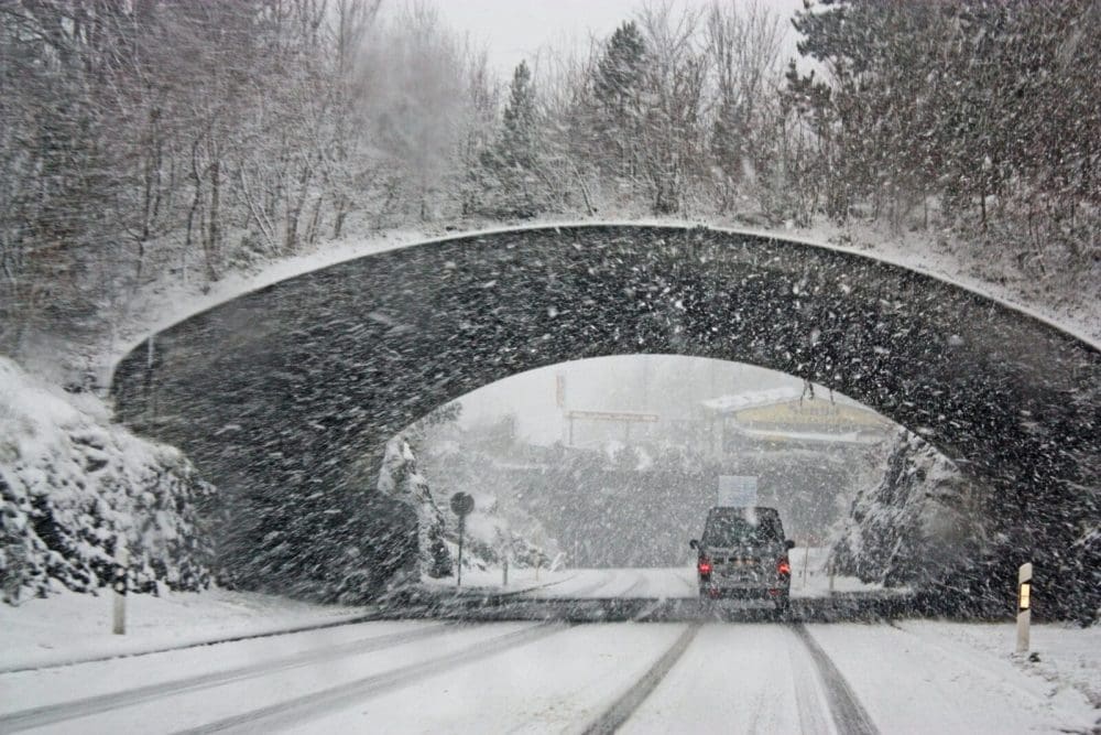
A fairly large winter storm will impact parts of New Jersey beginning late Wednesday, bringing a mix of snow, ice, and rain.
The storm will kick off with snow before transitioning to an icy mix and, eventually, rain. Conditions and accumulation will vary across the state, with northern and western counties expected to see more snow and ice than southern and coastal areas.
The National Weather Service has issued Winter Weather Advisories for much of the state, with precipitation expected to start late Wednesday evening and taper off by Thursday afternoon. Snow totals are projected to range from a coating to two inches, with ice accumulations up to a quarter-inch in some regions.
Drivers are advised to use caution, as icy conditions could make travel hazardous, particularly during the morning commute. Road crews are expected to be out treating highways ahead of the storm.
Rain is expected to clear out by Thursday afternoon, with temperatures rising and helping to melt accumulated ice and snow.
County-by-County Impact Breakdown
Warren County
Moderate impact. Snow starts at 1 a.m., transitions to an icy mix by 6 a.m., and rain by 10 a.m. Precipitation ends at 1 p.m. Total accumulation: 1-2 inches of snow, up to 0.25 inches of ice.
Union County
Minor to moderate impact. Snow begins at 1 a.m., changing to an icy mix at 8 a.m. and possibly lingering before ending at 2 p.m. Snow totals 1-2 inches, ice up to 0.10 inches.
Sussex County
Moderate impact. Snow starts at 2 a.m., shifting to an icy mix by 8 a.m. and may not fully transition before ending at 1 p.m. Snow accumulates 1-2 inches, ice up to 0.25 inches.
Somerset County
Moderate impact. Snow begins around midnight, transitioning to an icy mix by 5 a.m. and rain at 10 a.m. Precipitation ends at 2 p.m. Snow accumulation 1-2 inches, ice up to 0.25 inches.
Salem County
Minor to moderate impact. Snow starts at 7 p.m., becomes an icy mix by 11 p.m., and turns to rain at 7 a.m. before ending at noon. Snow totals up to 1 inch, ice up to 0.25 inches.
Passaic County
Minor to moderate impact. Snow starts at 2 a.m., turns to an icy mix by 8 a.m., and may not fully transition before ending at 2 p.m. Snow totals 1-2 inches, ice up to 0.10 inches.
Ocean County
Minor impact. Snow begins at 10 p.m., becoming an icy mix at 2 a.m. and rain by 6 a.m. Precipitation ends at 2 p.m. Snow totals up to 1 inch, ice up to 0.01 inches.
Morris County
Moderate impact. Snow starts at 1 a.m., turns to an icy mix by 7 a.m., and may not fully transition before ending at 1 p.m. Snow totals 1-2 inches, ice up to 0.25 inches.
Monmouth County
Minor impact. Snow begins at 11 p.m., changing to an icy mix by 3 a.m. and rain by 8 a.m. Precipitation ends at 2 p.m. Snow totals up to 1 inch, ice up to 0.10 inches.
Middlesex County
Minor to moderate impact. Snow starts at midnight, transitioning to an icy mix by 4 a.m. and rain by 9 a.m. Precipitation ends at 2 p.m. Snow totals up to 2 inches, ice up to 0.10 inches.
Mercer County
Minor to moderate impact. Snow begins at 11 p.m., turns to an icy mix at 3 a.m., and rain at 8 a.m. Precipitation ends at 1 p.m. Snow accumulation up to 2 inches, ice up to 0.25 inches.
Hunterdon County
Minor to moderate impact. Snow starts at midnight, transitioning to an icy mix at 5 a.m. and rain at 10 a.m. Precipitation ends at 1 p.m. Snow totals 1-2 inches, ice up to 0.25 inches.
Hudson County
Moderate impact. Snow begins at 2 a.m., turns to an icy mix by 9 a.m., and may not fully transition before ending at 3 p.m. Snow totals 1-2 inches, ice up to 0.10 inches.
Gloucester County
Minor to moderate impact. Snow starts at 8 p.m., becomes an icy mix at midnight, and turns to rain at 7 a.m. Precipitation ends at noon. Snow totals up to 1 inch, ice up to 0.25 inches.
Essex County
Minor to moderate impact. Snow begins at 1 a.m., changing to an icy mix at 8 a.m. and may not fully transition before ending at 3 p.m. Snow totals 1-2 inches, ice up to 0.10 inches.
Cumberland County
Minor impact. Snow starts at 7 p.m., turns to an icy mix by 11 p.m., and rain by 7 a.m. Precipitation ends at noon. Snow totals up to 1 inch, ice up to 0.10 inches.
Cape May County
Minor impact. Snow begins at 7 p.m., changes to an icy mix at 10 p.m., and rain at 5 a.m. Precipitation ends at noon. Snow totals up to 1 inch, ice up to 0.01 inches.
Camden County
Minor to moderate impact. Snow starts at 9 p.m., turns to an icy mix at 1 a.m., and rain at 7 a.m. Precipitation ends at 1 p.m. Snow totals up to 1 inch, ice up to 0.25 inches.
Burlington County
Minor to moderate impact. Snow begins at 10 p.m., transitions to an icy mix at 2 a.m., and rain at 7 a.m. Precipitation ends at 1 p.m. Snow totals up to 1 inch, ice up to 0.25 inches.
Bergen County
Minor to moderate impact. Snow starts at 2 a.m., changing to an icy mix at 9 a.m. and may not fully transition before ending at 3 p.m. Snow totals 1-2 inches, ice up to 0.10 inches.
Atlantic County
Minor impact. Snow begins at 8 p.m., turns to an icy mix at midnight, and rain at 5 a.m. Precipitation ends at 1 p.m. Snow totals up to 1 inch, ice up to 0.01 inches.
The New Jersey Digest is a new jersey magazine that has chronicled daily life in the Garden State for over 10 years.