The East Coast is already cold, already snow-covered, already worn down.
And now attention is shifting back to the weekend.
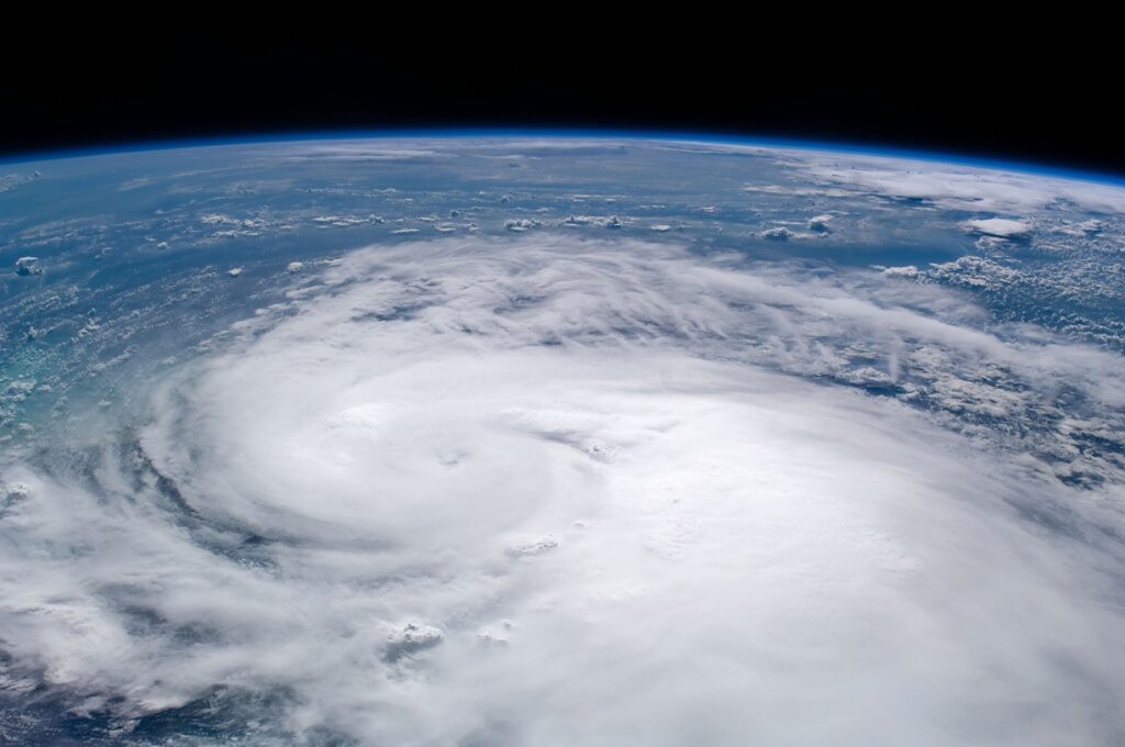
Another winter storm is organizing offshore, and forecasters are trying to figure out just how aggressive it might become as it moves north. The concern isn’t just snow. It’s how quickly this system could strengthen once it gets going—and what that might mean for the coast.
That’s where the phrase “bomb cyclone” enters the conversation.
It’s not a new storm, and it doesn’t mean anything is guaranteed. But it does describe something meteorologists take seriously: a storm that deepens fast, sometimes faster than expected, and hits harder because of it.
Right now, models show a strong system developing late Friday and into Saturday, bringing heavy snow to parts of the Carolinas and Virginia before edging toward the Mid-Atlantic. Farther north, the details are still messy. New Jersey and Delaware sit in that uncomfortable zone where small shifts could matter a lot.
The cold air is already in place. That’s not changing.
Overnight wind chills are expected to stay brutal through the end of the week, which means anything that falls is likely to stick. By Sunday, parts of New Jersey could see several inches of snow or a wintry mix—or less than that—depending on how the storm behaves offshore.
That uncertainty is the point.
A bomb cyclone isn’t a separate category of storm. It’s what happens when a developing system suddenly feeds off sharp temperature differences between land and ocean. Cold air pours south. Warmer air rises off the Atlantic. Pressure drops quickly. Winds respond.
Sometimes this all happens far enough offshore that impacts stay limited. Other times, it doesn’t.
Along the coast, forecasters are also watching tides and surf. Strong onshore winds combined with already high astronomical tides can create flooding even without record rainfall or snowfall. That kind of impact tends to sneak up on people.
New Jersey has seen storms like this before. Not every winter, but often enough that the word “bomb” catches attention. In recent years, rapidly intensifying nor’easters have delivered heavy snow, power outages, and travel chaos with little warning once the pieces locked into place.
Right now, nothing is locked.
The storm could strengthen offshore and slide north with limited effects. Or it could deepen closer to the coast, pulling heavier snow and stronger winds inland. Forecasters will know more as the weekend gets closer.
For now, the setup is there. The cold is entrenched. The ocean is relatively warm. And the atmosphere is watching to see what happens next.
So is everyone else. So, New Jersey, it might be time to get the snow blowers out once more.
The New Jersey Digest is a new jersey magazine that has chronicled daily life in the Garden State for over 10 years.