
While we are all striving to be socially distant, we’re also anxious to get out of the house. Taking a hike just might be the perfect solution. Luckily, Northern New Jersey hosts a variety of state parks and reservations that can be enjoyed by beginners and avid hikers alike. To appease both nature enthusiasts and history buffs these parks offer breathtaking scenery rich in wild and plant life, as well as historical trails, ruins and monuments. There is something for everyone in the wilderness of hiking in North Jersey.
Ramapo Mountain State Forest
Bergen and Passaic Counties
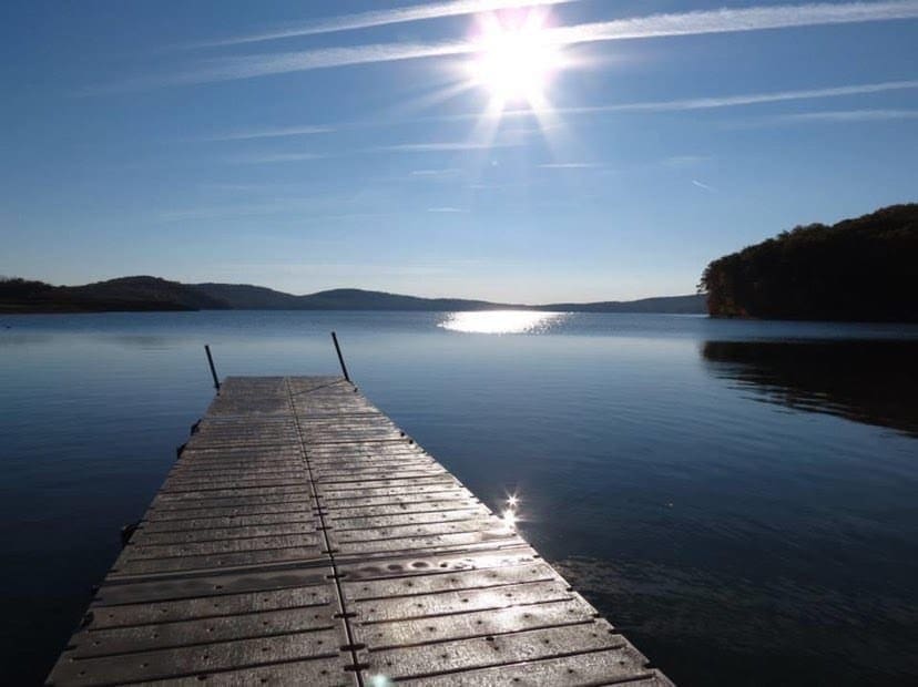
At a whopping 4, 268 acres Ramapo Mountain State Forest offers adventurers 21 different trails to hike, bike or run. Most of the treks are classified as moderate that vary in elevation but provide beautiful sights like waterfalls and wildflowers for bypassers. The easier, flatter path runs along the lake. The Van Slyke Castle Loop (2.3 miles) is a popular one and leads to ruins of a mansion estate, built in the early 1900s by a stockbroker high in the hills of the Ramapo Mountain Range.
GPS Address: 67 Skyline Drive, Oakland, NJ.
Garret Mountain Reservation
Passaic County
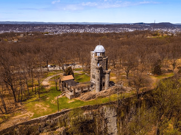
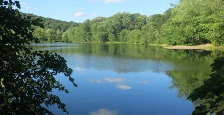
A quick escape from urban life Garret Mountain kicks off New Jersey’s Watchung Mountain Range. Its northernmost peak reaches 500 ft. above sea level, providing a scenic overlook of nearby neighborhoods. The 568-acre park has multiple beginner-friendly hiking trails, picnic areas and grassy meadows. The reservation harbors over 150 species of birds, as well as Barbour’s Pond, where recreational fishing is permitted. On the eastern slope, you’ll find Lambert Tower, a 19th-century castle which is now home to the Passaic County Museum.
GPS Address: 8 Mountain Ave, Woodland Park, NJ
Eagle Rock Reservation
Essex County

This 408-acre woodland sits at the crest (highest point) of the First Watchung Mountain, on the borders of Verona, Montclair and West Orange. Eagle Rock offers a total of 4 fairly easy trails for leisurely hikes, under the shaded canopy of the trees. Lengths range from 1 to about 3.5 miles and terrain varies between slightly rocky and boggy. If you’re looking for a scenic trail the Blue is recommended. Speaking of scenic, don’t leave without checking out the overlook. There you’ll find the 9/11 Memorial and a vast view out into the east, a tiny Manhattan skyline in the distance. Consider using the All Trails App to check out reviews from other hikers, users have been reporting that trails here are poorly marked and the maps provided by the app are helpful.
GPS Address: Eagle Rock Ave &, Prospect Ave, West Orange, NJ.
The Watchung Reservation
Union County

Stretching across 2,000 acres The Watchung Reservation offers an abundance of sights for nature lovers and history fanatics alike. According to All Trails, most of the 15 footpaths are easy to moderate and tend to get quite muddy. The mileage of the trails varies between 1.5 to 9. A 6.3-mile History Trail provides its travelers with informational markers and ruin sites, like the Deserted Village of Feltville. The park’s layout was designed by none other than the Olmsted Brothers, the architects behind Central Park. The Watchung Reservation sits in the upper valley of Blue Brook.
GPS Address: Historic Trail, Mountainside, NJ.
Hacklebarney State Park
Morris County

“Choose your own adventure” at Hacklebarney State Park. Due to the current pandemic, all hiking trails follow a new one-way traffic pattern, with intersecting points and shortcuts. Head towards the north portion of the park for the best views of the gorge and the majestic Black River that runs through it. Durable shoes are a must and no bikes are permitted on the trails as the topography is rocky and jagged. Among the rich and thick foliage, you’ll find several species of endangered plants. Wildlife like dear, black bear and fox also call this forest their home. Hacklebarney State Park covers a glacial valley.
GPS Address: 119 Hacklebarney Rd, Long Valley, NJ
Highpoint State Park
Sussex County
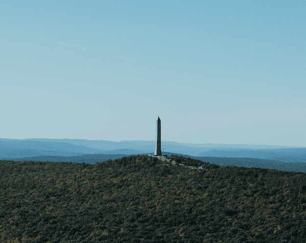
Set along the Kittatinny Mountain range and the Appalachian Trail, you’ll find Highpoint State Park. At 1,803 ft. above sea level, the peak is one of the highest points in New Jersey. The 360 view from the top of the High Point Monument consists of rolling valleys of our neighboring states and the Delaware River. The monument is a memorial for all NJ war veterans, and there are several trails that lead up to it. Highpoint State Park consists of over 50 miles of trail through diverse landscapes from ridges, to wetlands, dense woods and fields. The park is also home to the Atlantic White Cedar Swamp and an effortless 1.5-mile hike through it. From Memorial Day to Labor Day a vehicle fee is charged, visitors are welcome to enjoy swimming in designated areas of Lake Marcia.
GPS Address: 1480 NJ-23, Sussex, NJ.
Worthington State Park
Warren County

Way out west in the New Jersey Skylands region, Worthington State Park is worth the long drive. Outstanding views of the Delaware Water Gap and neighboring Mount Minsi on the PA border await those daring enough to make the journey to the top of Mount Tammany, about 1,509 ft. above sea level. The 2.3 mile Red Dot trail is challenging, even for more advanced hikers. Shortly after the first lookout area hikers should be prepared to do some moderate rock climbing. It’s best to leave your dog at home for this hike, they are permitted but the rocky and steep portions prove to be difficult for them. The peak offers the most breathtaking view. The descent of Blue Dot Trail goes much smoother, letting out into a creek where worn-out hikers can cool down. With 26 miles of trails, including 7 miles of the Appalachian Trail, there is something for hikers of all levels. Other attractions include Sunfish pond and the historic Rockcores trail.
GPS Address: Tammany Red Dot Trail or 2 Old Mine Rd. Columbia, NJ for parking lots closer to other trails.
Round Valley Recreation Area
Hunterdon County

The sight to see here is the Round Valley Reservoir, one of the largest and deepest lakes in New Jersey, its freshwater crystal clear and vast shades of blue. If you’re solely here to hike, the unmarked trail that runs along this gorgeous body of water is a must, it starts off at the boat launch area. There are 5 marked trails accessible from the South Parking Lot. They loop into each other and provide views of the reservoir. Swimming is permitted in designated areas from Memorial Day to Labor Day, vehicles are subject to entrance fees during those dates. Check out Round Valley’s website for more information on activities like boating/kayaking, camping, fishing and even scuba diving.
GPS Address: 1220 Stanton Lebanon Rd, Lebanon, NJ
For more outdoor sightseeing, check out these New Jersey abandoned attractions.
A writer and astrologer, sustained by iced coffee, sunsets and decorating her home. For more on her services and where her insights can be found, visit cosmickait.com.
